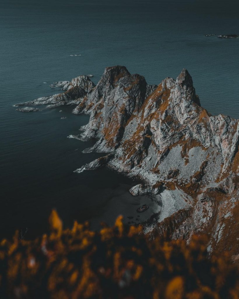
From Jæren in the south, to Varanger in the far north, these Scenic Routes have been carefully curated to present the most spectacular sights that Norway has to offer. When you choose to explore these roads, you will not only experience stunning views of fjords, mountains, waterfalls, and glaciers, but you will also enjoy architecture, art and perfectly placed viewpoints that are especially created for these routes.
The routes cover a total of 1,850 kilometres and they are found both along the West Coast of Norway, all the way up in Northern Norway and also in the mountains of Southern Norway.
The Norwegian Public Roads Administration is responsible for the selection of these highways, based on nominations from the different counties of Norway. The 18 winning roads were added to this list for both their picturesque scenery and tourist-friendly infrastructure, such as rest stops and viewpoints, to make the experience a comfortable one, as well as a beautiful exploration of the best of Norwegian nature and art.
Jæren
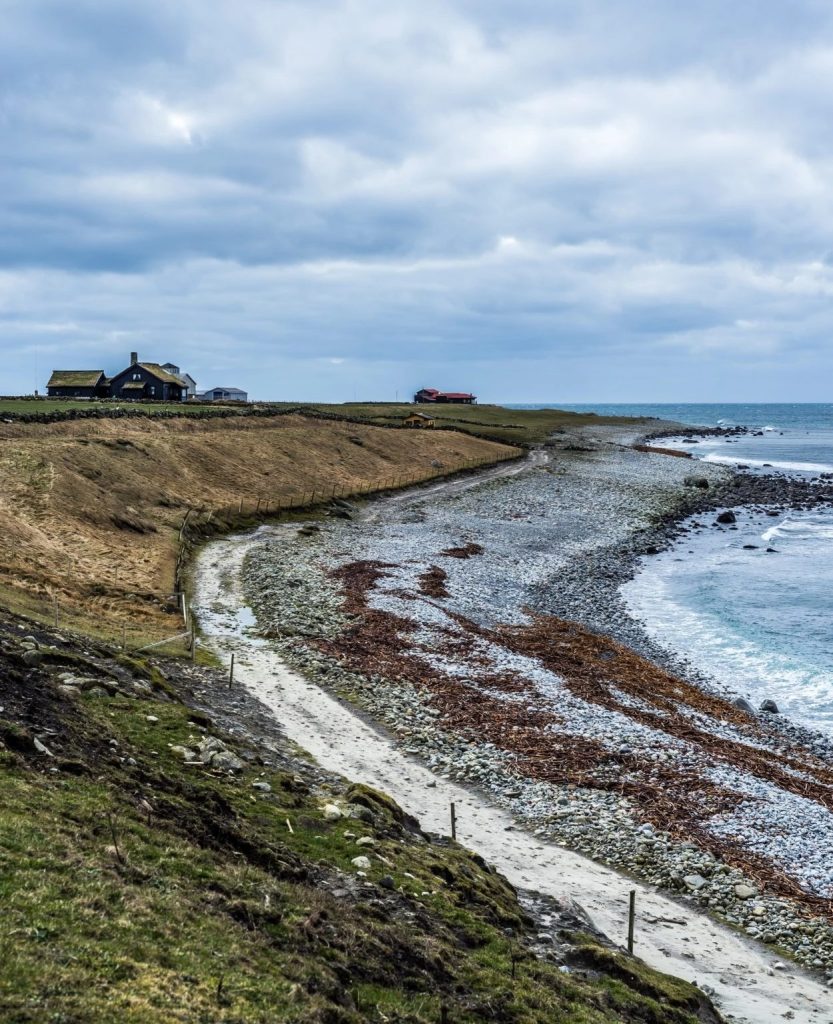
First stop, Jæren, in the south of Norway. The scenic route here stretches 41 Km between Ogna and Bore. This road may seem plain and ordinary at first look, as you will share the road with all the people who live there. As you continue exploring you will see that this is a very different view than you will find in other parts of Norway.
A magnificent light gives great photo opportunities on both sunny and rainy days. If you want a break along the way, visit the Kvassheim lighthouse, situated against the background of the open ocean and an ever-changing sky. If you enjoy a day at the beach, there are both sandy beaches and pebbly beaches along this road. Learn more about beaches in Norway here (link to popular beaches in Norway).
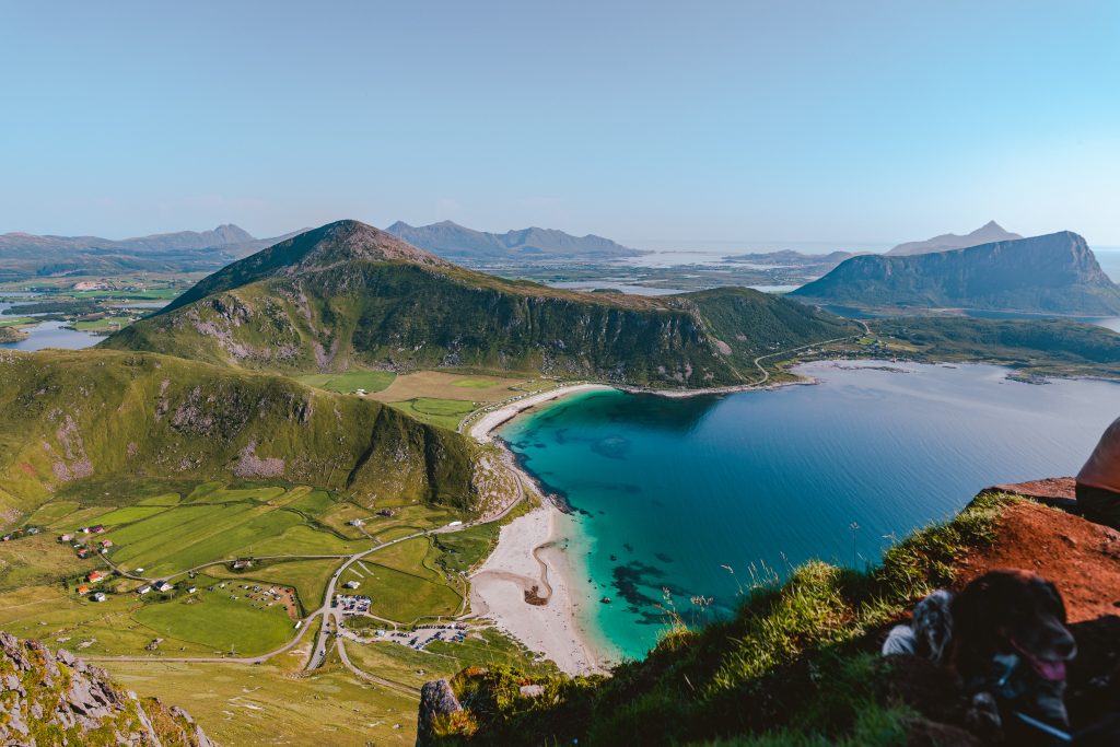
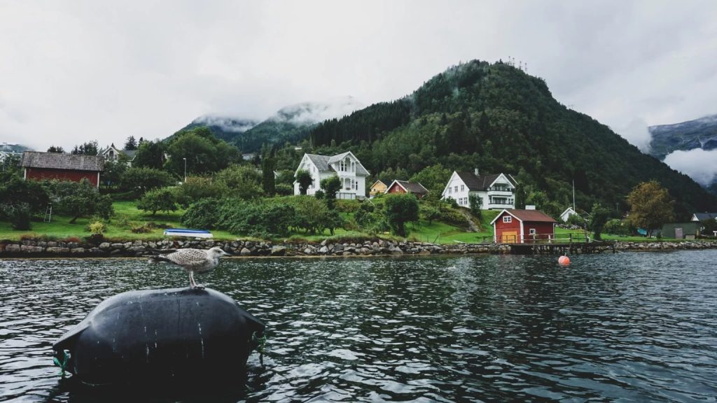
Ryfylket
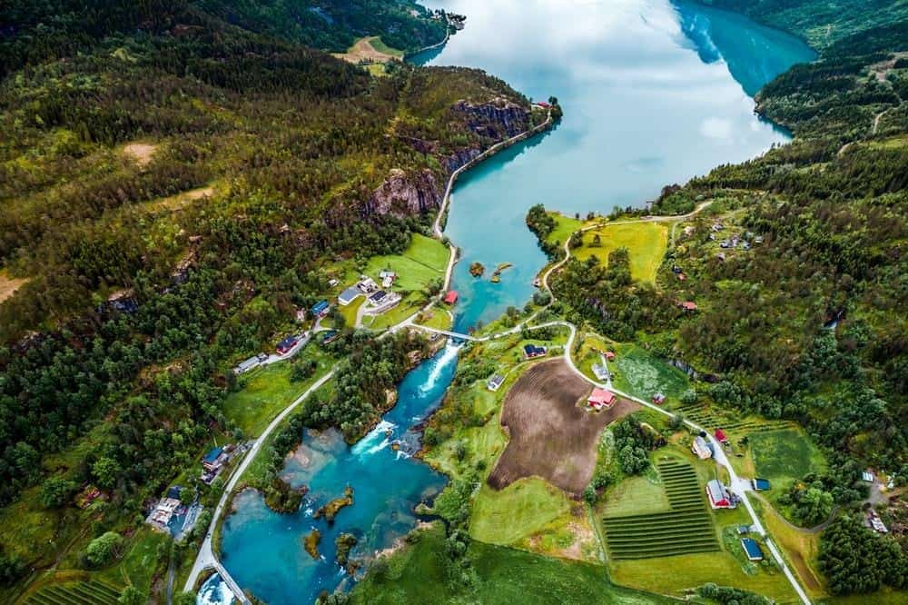
Next drive, Ryfylke, a 260 Km drive from Oanes via Sauda to Horda, including 2 ferries. This is a trip full of contrasts with high barren mountains, lush hillsides, sheer mountainsides and deep fjords. A popular attraction is the Svandalfossen waterfall. You can walk up the steps to the waterfall and get close to the power of the massive water flowing down the mountainside.
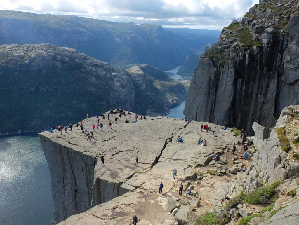
If you feel like a detour from the main road, the famous Preikestolen (Pulpit Rock) and the Kjerag boulder beautifully set with the Lysefjorden in the background are two photo opportunities not to be missed. During this trip, there are two ferries where you can take in a fresh breath of air from the fjords and relax before the next drive. Maybe you will enjoy the Norwegian pancake “Svele” while you are on the ferry.
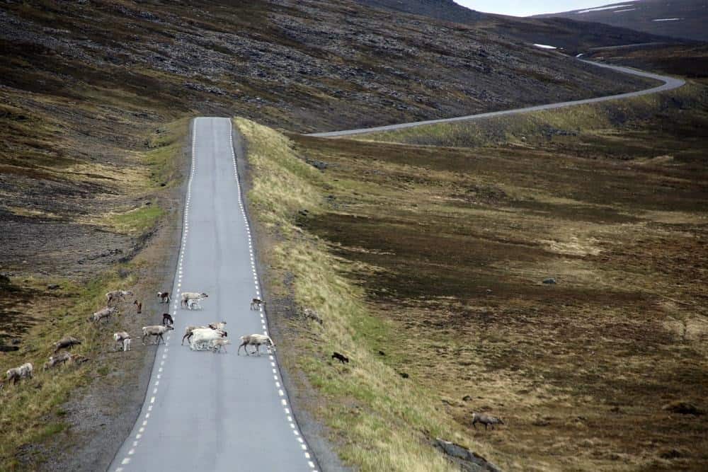
Hardangervidda
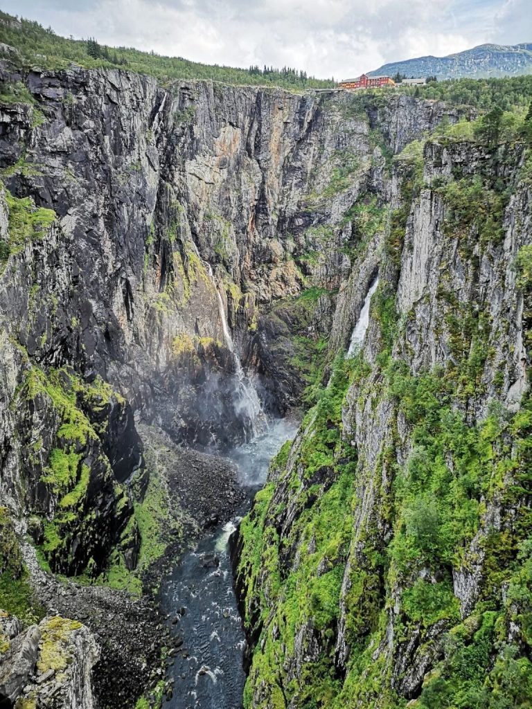
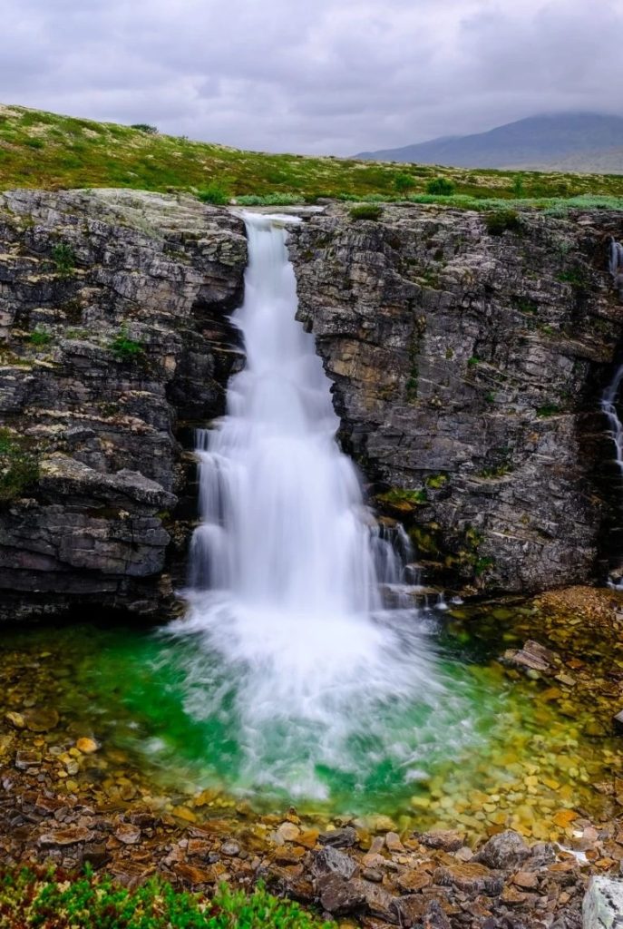
Hardangervidda, maybe the most famous route in Norway, is our next track. It covers a total of 67 Km between Halne–Steinsdalsfossen, Jondal–Utne and Kinsarvik–Tyssedal which varies between fjordlandscape, moorlands, mountainsides and glaciers.
Scattered with waterfalls, including Vøringfossen and Steinsdalsfossen, this area is the epitome of Norwegian romantic nationalism. Vøringsfossen is in fact Norway’s best-known waterfall, and it’s easy to understand why it makes such an impact, with a free fall of 182 metres. An impressive sight!
If you are lucky you may get to see reindeer strolling along the Hardangervidda, who inhabits one of the biggest populations of wild reindeer in Europe.
Aurlandsfjellet
Aurlandsfjellet is the route of 47 Km between Aurlandsvangen and Lærdalsøyri, including the Lærdal Tunnel – known to be the world’s longest road tunnel. The road tracks over the mountains and the highest point is 1,306 metres above sea level. In the winter, the road is closed. Snow covers the mountain throughout large parts of the summer, giving it the nickname “The Snow Road”.
Along the way you encounter the popular viewpoint Stegastein (link til Flåmartikkel). This spectacular viewpoint is considered a piece of art worth seeing in itself, and the view from it is known to be quite breathtaking. This drive will take you from fjords to mountains, through lush valleys and stony wastelands of the high mountain region. There are many great contrasts to discover along this route.
Gaularfjellet
Gaularfjellet, another mountain route to explore, 114 Km between Balestrand and Moskog. Passing lakes, rapids and waterfalls, and varying between steep mountain climbs and sheltered valleys, this route will at times feel like the road is clinging to the fjords. The rest area Utsikten is the perfect place for you to admire the panorama of mountains and valleys.
If you want to take a break from driving and stroll along by foot, a continuous “waterfall path” of almost 25 km is established from Nystølen to Eldal. Walk the entire tour or just take a short stroll to admire the watercourse up close. For the adventurous there is a flexible steel bridge at Likholefossen waterfall that will give you the whirling sensation of being in the midst of the waterfall itself.
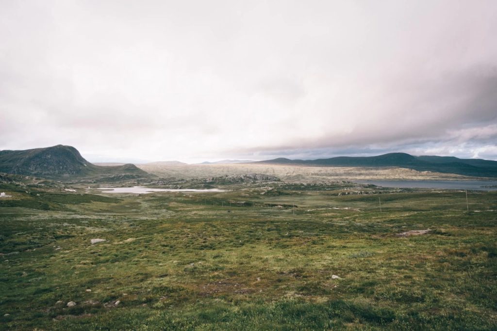
Valdresflye
Valdresflye, a 49 Km route between Garli and Besstrond, is a mountain plateau where the road reaches 1,389 m (4,557 ft) above main sea level. From the plateau itself the route has views towards Jotunheimen National Park, and further down the road, it passes through a cultivated landscape with mountain pastures.
If you crave a break from driving, you can stop almost anywhere and go for hikes in the mountains. There are also stops especially design for this, like Rjupa and Vargbakkene. You will encounter summer mountain farms along the way, where you can by organic butter, sour cream and cheese produced locally in the traditional Norwegian way. A taste of Norway indeed!
Sognefjellet
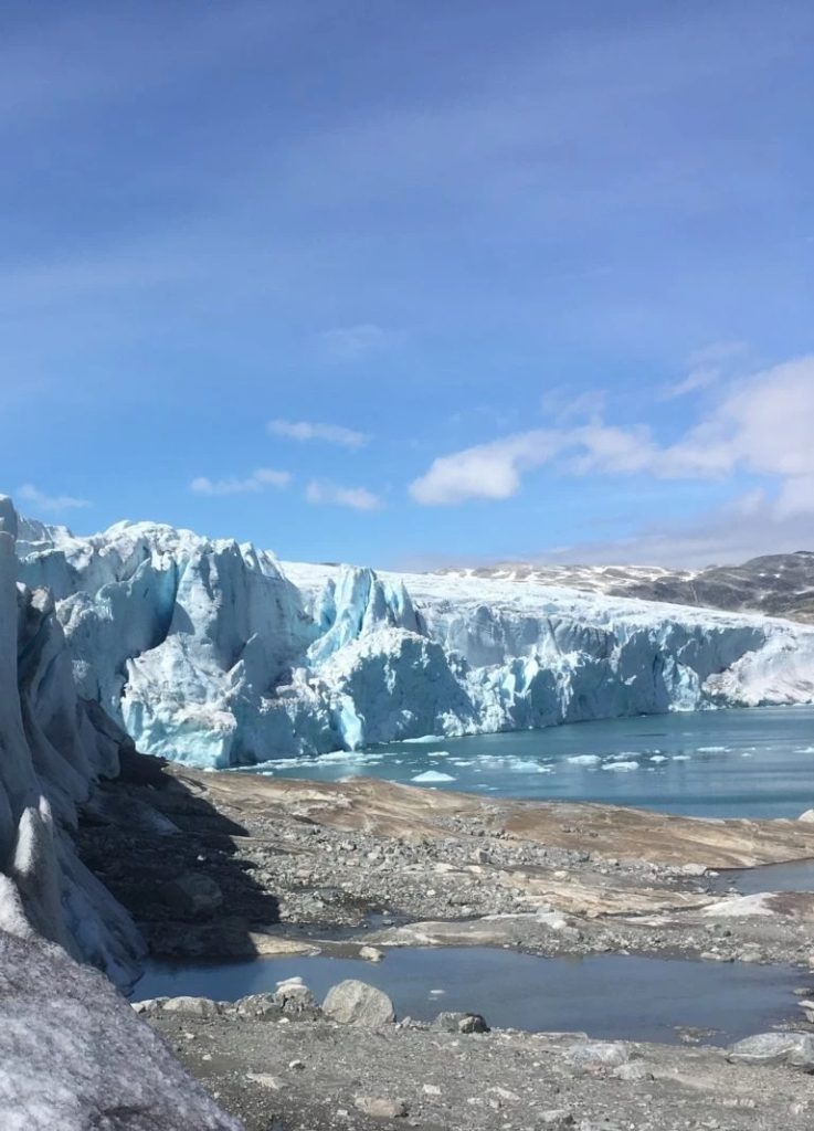
Our next route, Sognefjellet consists of 108 Km from Lom to Gaupne. Sognefjellet is the highest mountain pass in northern Europe at 1,434 m (4,705 ft) above main sea level. This road is only open during summer, as the snow banks on the side of the road can be up to 10 m (30 ft) tall. This route provides access to two National Parks, both Jotunheimen and Jostedalsbreen . On this road trip you can enjoy magnificent views of meltwater green mountain lakes, glaciers and mountain peaks.
If you want to visit a cultural site, the beautiful Lom Stave Church can mark the start or end of your trip. Lom is also known to be the right place to eat a fine meal with local products. If you want to go hiking, the Jotunheimen mountains have an infinite number of hiking options, with alternatives to suit everyone, from beginners to experienced.
Rondane
Rondane is a 75 Km route from Enden to Folldal. The first National Park of Norway was established here in 1962. Rondane National Park tells the story of Norwegian settlements as early as the Stone Age. This unique cultural landscape presents with mountains well suited for hiking, and exploring the wilderness of Norwegian nature. A wide selection of tourist cabins are to be found, and hiking paths that are well signposted makes it easy to take the whole family hiking.
Many Norwegian artists have been inspired by the changing weather and light in the landscape at Rondane. If you visit the Sohlbergplassen viewing platform at Atnsjøen, the view is in fact from the same angle as the famous painting “Winter’s Night in Rondane” by Harald Sohlberg.
Gamle Strynefjellsvegen
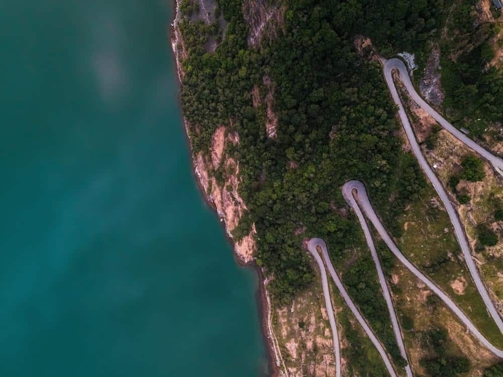
Next stop is the Gamle Strynefjellsvegen, a 27 Km route between Grotli and Ospeli. This road connects the mountain village of Skjåk with the fjord village of Stryn. You can travel this route and see round, glaciated forms in the east as well as a steep, rugged topography in the west. If you enjoy skiing, it is usually possible to do even into the summer. Normally the road opens in June.
This road has impressed travellers for a century. A landmark in its own right, this road is a masterpiece of engineering design from the old days. Created with bare hands and tools from a bygone time towards the end of the 19th century, this route has a historical presence like few others.
You can see the guard stones by the side of the road and admire the old stone masonry, getting a sense of travelling back in time to another era. Do you hear the sound of hoofs clacking? When the road was built, horses were the main transport. Viewpoints at the Øvstefossen and Videfossen waterfalls is worth a refreshing stop along the way.
Geiranger – Trollstigen
Geiranger – Trollstigen – this is perhaps the most dramatic 104 Km that you will ever drive. From Langevatn to Sogge Bridge, this route includes the most nerve-wrecking hairpin turns in all of Norway at Trollstigen. Then you drive through the Geirangerfjord, a World Heritage Site, where the road follows the fjordside until reaching Geiranger. The mountains surround the fjord in a spectacular manner, and it really must be experienced, as words really cannot describe it.
Along the way, please stop and enjoy the viewing points Ørnesvingen, Gudbrandsjuvet and Flydalsjuvet, who all are made to let you explore your natural surroundings in a unique way. The ferry on the Geirangerfjord will bring you up close to the famous waterfalls Dei Sju Systre, Friaren and Brudesløret. This is a road trip you will never forget.
Atlanterhavsveien
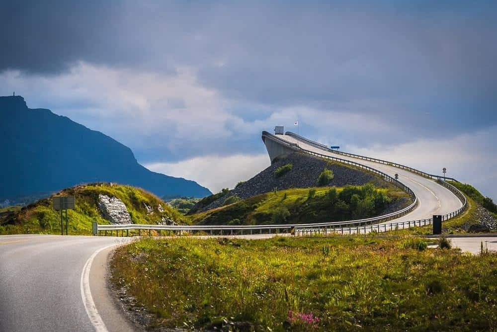
Not too far from Geiranger, you will find Atlanterhavsveien, The Atlantic Ocean Road, 36 Km from Kårvåg to the old fishing village of Bud. This scenic route is built across small unsheltered islands and skerries spanned by eight bridges, several causeways and viaducts. If you love the ocean, this is the road you are looking for.
Atlanterhavsveien and its combination of modern design and nature, creates a unique driving experience where you feel as close to the elements as if you drive on the ocean itself. A modern road who is visually stunning as you float from islet to islet in the ever changing weather.
The construction workers that built this road experienced a total of twelve hurricanes during their six years of work. In 2005 Atlanterhavsveien was chosen as the Norwegian construction of the century.
If you love fishing, make a stop at one of the fishing bridges, and get your catch of the day.
Helgelandskysten
From the West Coast of Norway, we make a jump up north to the longest of our Scenic Routes, Helgelandskysten. Be prepared for this 433 Km long ride that includes 6 ferries and a multitude of natural and cultural experiences.
Among these are Saltstraumen, the world’s largest tidal maelstrom, Svartisen, Norway’s second largest glacier, and Torghatten, a peak shaped like a hat with a natural hole through it. This drive follows the coast and displays a wonderful multitude of scenery as it changes from fjords and rough mountains to islands at sea and a calmer landscape.
The Vega Islands are featured at the UNESCO World Heritage list, and is a popular stop along the way. At 66 degrees northern latitude you will cross the Arctic Circle and maybe you will get a glimpse of the famous Midnight Sun.
Next stop in the North is Lofoten, 230 Km from Fiskebøl to Å. The Lofoten archipelago has something for everyone. An open sea, white beaches, crystal clear water and steep mountains. You can visit fishing hamlets that offers their rorbu cabins for rent, combining cultural heritage with modern accommodations.
The Arctic winter is actually the perfect time to see the Northern Lights, but every time of year has great entertainment value in this part of Norway. If you love exploring there are lots of activities along the way.
Surfing, kayaking, hiking and fishing are some of them. For photographers and painters, this has been a favourite location for centuries, as the nature is stunning, and the light is really something special. In the summertime, cycling is a good alternative to driving in Lofoten.
You will also find some of Norway’s best beaches in Lofoten (link to blog on beaches in Norway).
Andøya
Further north you will find Andøya, a 58 Km route from Åkneskrysset to Andenes. This road runs along the west coast of Andøya, the northernmost island of the Vesterålen archipelago. Andøya features Norway’s largest marshes; whales, seals and bird rocks can all be seen out in the Norwegian Sea.
The rock formation Bukkekjerka is situated between Nordmæla and Nøss, an extraordinary place where nature has built a natural altar and pulpit. You can explore at sea by kayaking. In the summer it is great to explore this island by bike. Maybe you will find some tasty cloudberries at the moores if you visit later in the summer.
A brand new attraction is the Spaceship at the Andøya Space Center where you can learn more about outer space and the northern lights. Andøya has actually been a part of Norway’s space travel history, since they launched a research rocket in 1962. The Andøya route connects to our next National Tourist Route Senja by ferry.
Senja
Senja, our next route is a 102 km drive from Gryllefjord to Botnhamn, following the west coast of the island of Senja, passing through several fishing villages. Mountains are plunging steeply into the ice cold blue sea, not inviting others than Vikings to take a swim, even in summer. At Bergsbotn you will find a viewing platform allowing you to look out over Bergsfjorden and further across the vast ocean.
For those who love to explore the outdoors where you can enjoy hiking, paddling, diving or free riding down steep hills, Senja is truly a playground for you. Endless opportunities to explore wild Nordic nature and challenge yourself and the natural forces. You will also find activities for families like fishing, visiting the lovely beaches and less challenging hiking activities.
Havøysund
Havøysund is our second last trip. This route runs for 67 Km from Kokelv to Havøysund. A stretch of deserted Arctic wilderness, there is the sea on one side and the majestic mountains on the other side. Unpopulated and deserted, only a handful of villages is populated.
The fishing village of Havøysund where the trip ends, as well as the small villages Kokelv, Slåtten and Snefjord along the route. The landscape by the road is desolate and can give you a feeling of travelling a road that no one has travelled before. Still you can encounter wildlife like reindeer and sea eagles.
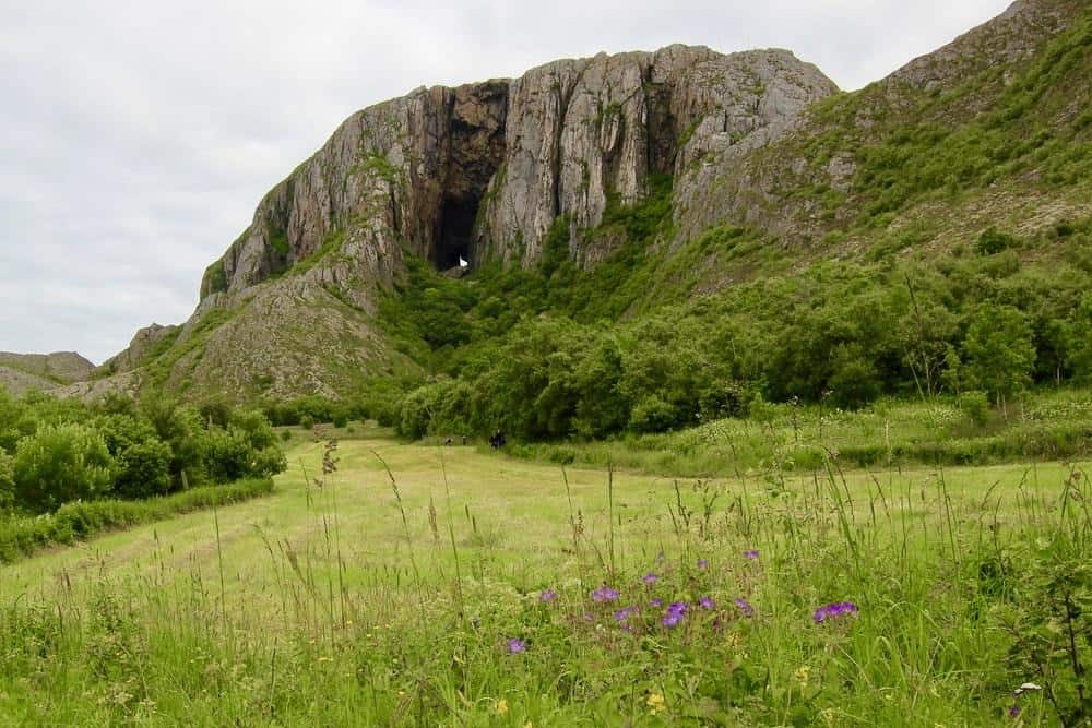
The historic Russehula cave can be found at the northeast of the Havøya island. There are also popular hiking opportunities nearby at Sukkertoppen and Nipen, south of Havøysund. The view from Sukkertoppen reaches across to Porsanger, the North Cape and far out into the Barents sea.
Deep sea fishing is also a popular activity in this area, and you can enjoy the Midnight Sun in the summer, and spectacular Northern Lights in the winter.
Varanger
Our final stop and last Scenic Route is Varanger, a 160 Km drive from Varangerbotn to Hamningberg. This route follows the east coast of Varanger, who borders to the Barents Sea. This area has rich traditions within trade and is a melting pot of Russian, Finnish, Norwegian and Sami culture.
Not every aspect of history is pleasant, and this area is also known for the witch trials in Finnmark in the 17th century. 91 victims were found guilty of witchcraft and burnt at the stake. The landscape may be as gloomy as the history at times, but still you will find a wildlife like nothing else in the world.
Bring your binoculars and take some time to study the bird life, there are plenty of rare bird species here. Find your spot in one of the several bird-watching hides along the way, there you can enjoy the landscape and the wildlife, well sheltered from the ever changing weather.
Steilneset Memorial and Vardøhus Fortress are two interesting sights to visit during this trip.
If you want to read more about the Norwegian Scenic Routes, visit nasjonaleturistveger.no